
How a unit becomes a plan, and how the plan comes with you.
At your desk: you describe the hunt, Glassline narrows the ground, drafts the plays, and prices the packout. On the mountain: the playbook comes with you on your phone, signal or not. Nothing here is a template — every plan is built from your inputs.
The proof: every dataset FAQ
See it work, start to finish.
A tour of Glassline in the live app — describing the hunt, narrowing the unit, and building the playbook. The same four steps below, walked end to end.
Plan from home.
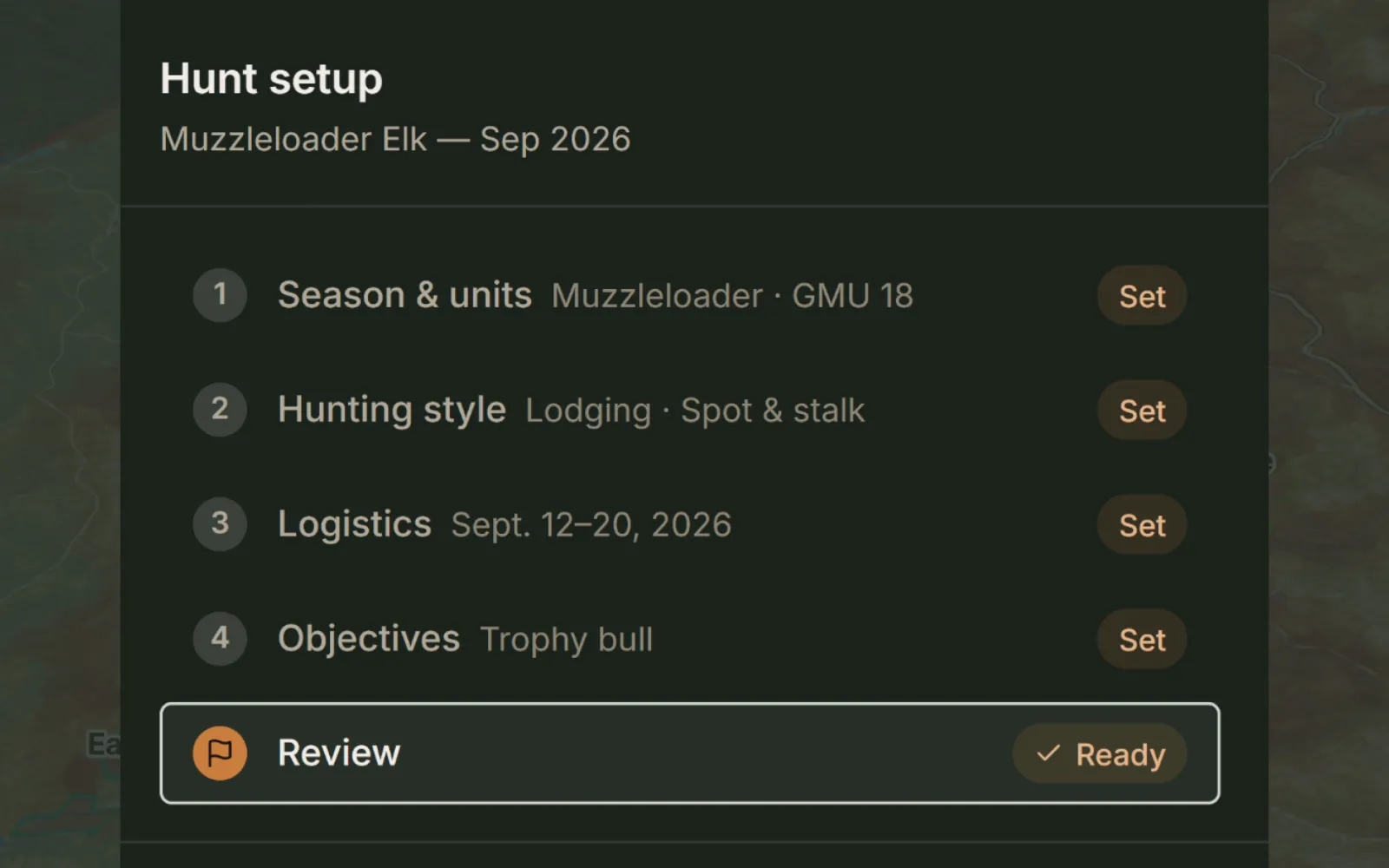
Describe the hunt
Unit, season, weapon, party and objectives. Your vehicle, which decides the roads and trailheads open to you. Where you’ll sleep — lodging, base camp or backcountry. The tactics you’d rather hunt: spot and stalk, calling, still hunting, water or wallow sits. And how an animal comes out: backpack, game cart or pack animals. Every play is written against these.
Describe the hunter
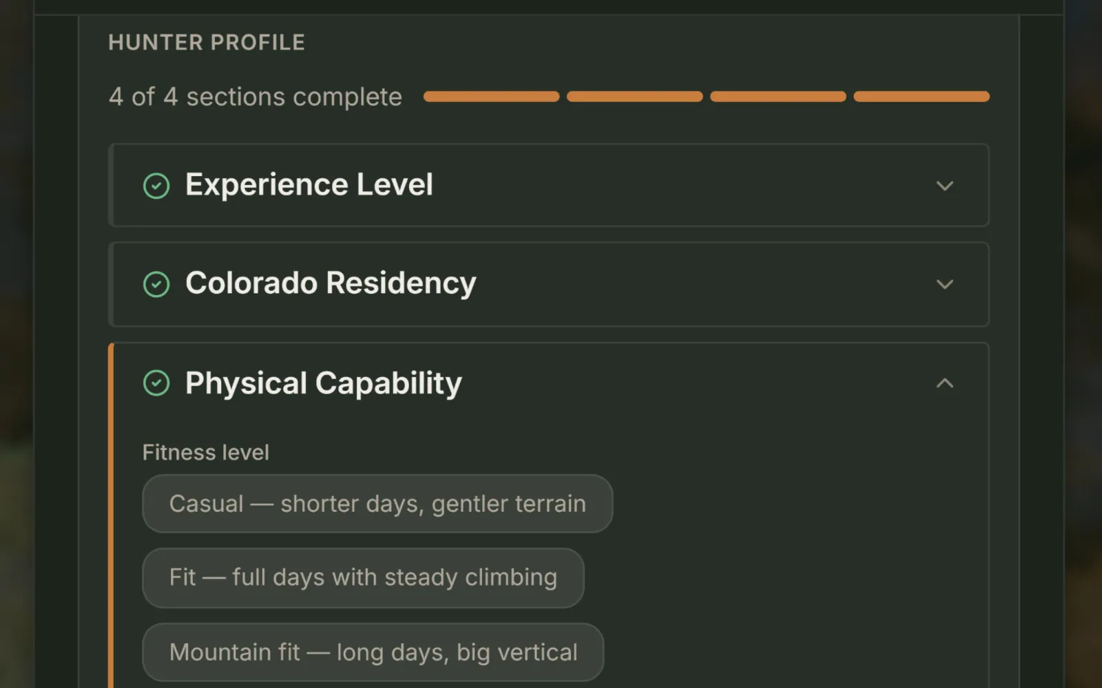
Fitness, and the numbers under it: how far you’ll hike in a day, how much weight you’ll carry a trip, the highest elevation you’re comfortable working. Routes are assembled inside those budgets, so a play you couldn’t walk never reaches the book. Up to two Stretch plays sit just past a budget, labeled so you can decide. Routed for your fitness, not flagged after.
Narrow the unit
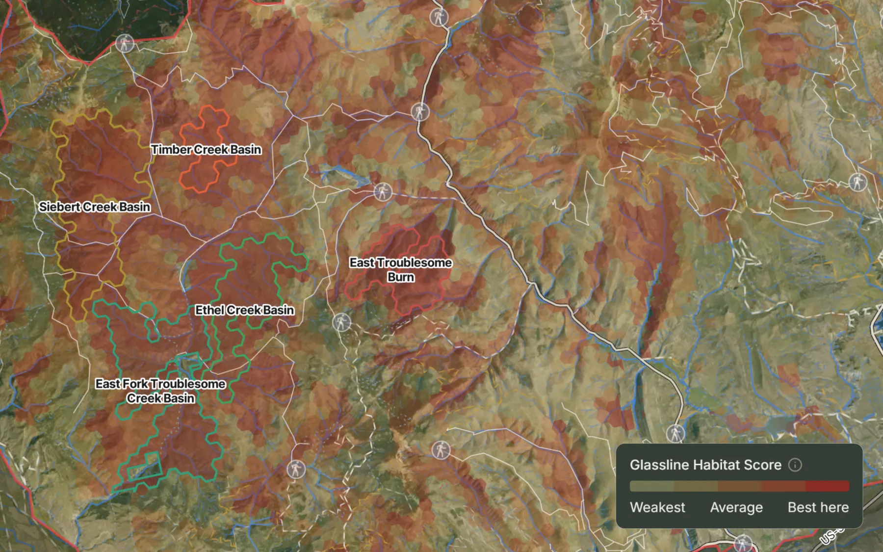
Public, huntable ground first. Current-year burns buffered and cut. Then the state’s seasonal range layers and the elevation band that matches your season. What’s left is scored cell by cell and ranked on habitat, method fit, trailhead access, feature diversity and pressure. Modify the generated hunt areas and add your own. Prioritize them to focus your hunt.
Build the playbook
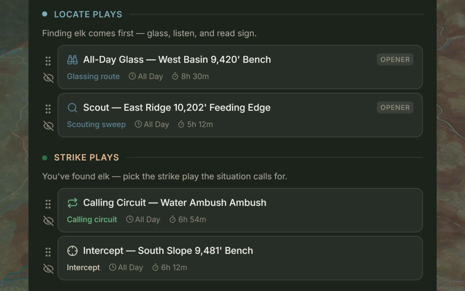
Every setup across your prioritized hunt areas becomes a scored opportunity, weighted by method fit, area priority, pressure and elevation. Routes are built from the highest-scoring of them and held inside hard ceilings: the legal shooting light of your dates, your foot-travel hours, your climb budget.
Four factors, re-weighted every season.
Food, water, breeding cover and shelter, scored from terrain, canopy, hydrography and greenness data. The weights change with the season — the same drainage scores differently in September than it does in November. Ground that sits near features like wallows and benches scores a little higher.
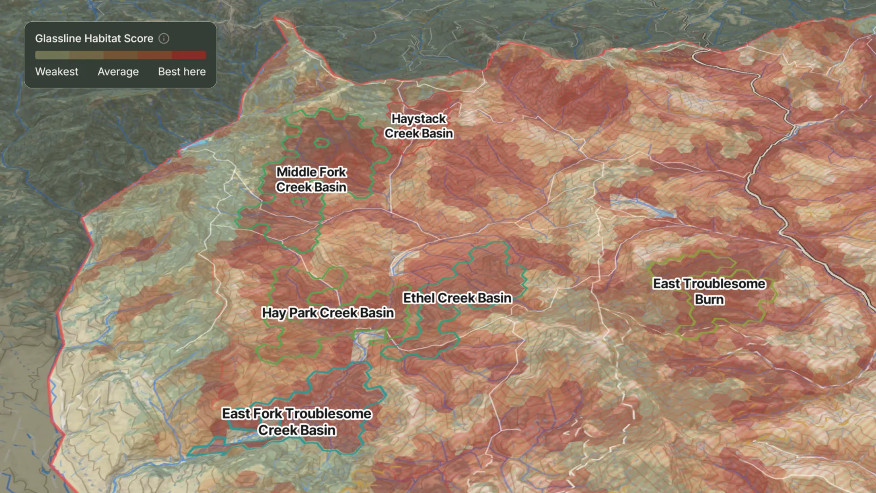
Terrain suitability, weighted by season. Not animal tracking.
The ground the plan reads, on your map.
Habitat scores start from terrain. The same terrain is on the map for you to read yourself: lidar relief under the timber, shadow by the hour, and a filter for the ground you have in mind.
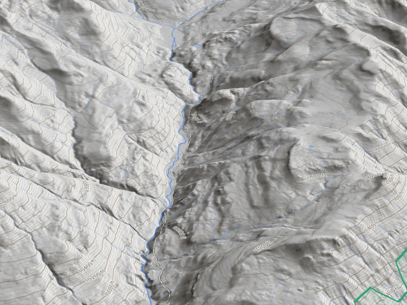
LiDAR
Bare-earth relief from USGS lidar at 5 m. Benches, cuts, old roadbeds and slide paths show through the canopy. Free, like the Slope angle, Aspect and Landform layers, and all four download with offline maps.

Sun and shade
Terrain shadow on any day, every half hour from sunrise to sunset, worked out from the horizon in every direction out to 15 km. Tap a spot and it reads in sun or in shade. Available for members only on the web.
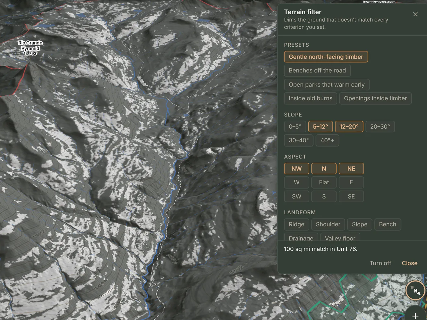
Terrain filter
Select slope bands, aspects, landforms, open or timber from lidar, public land, old burns, an elevation range and the foot-effort from a road your vehicle can drive. The result is highlighted on the map. Available for members.
How you get in, how far you go, and how you get out.
If the road closes in September, the trailhead doesn't fit your vehicle, or the packout takes three days, it doesn't matter how good the habitat looks. Glassline weighs all three before an area is ranked.
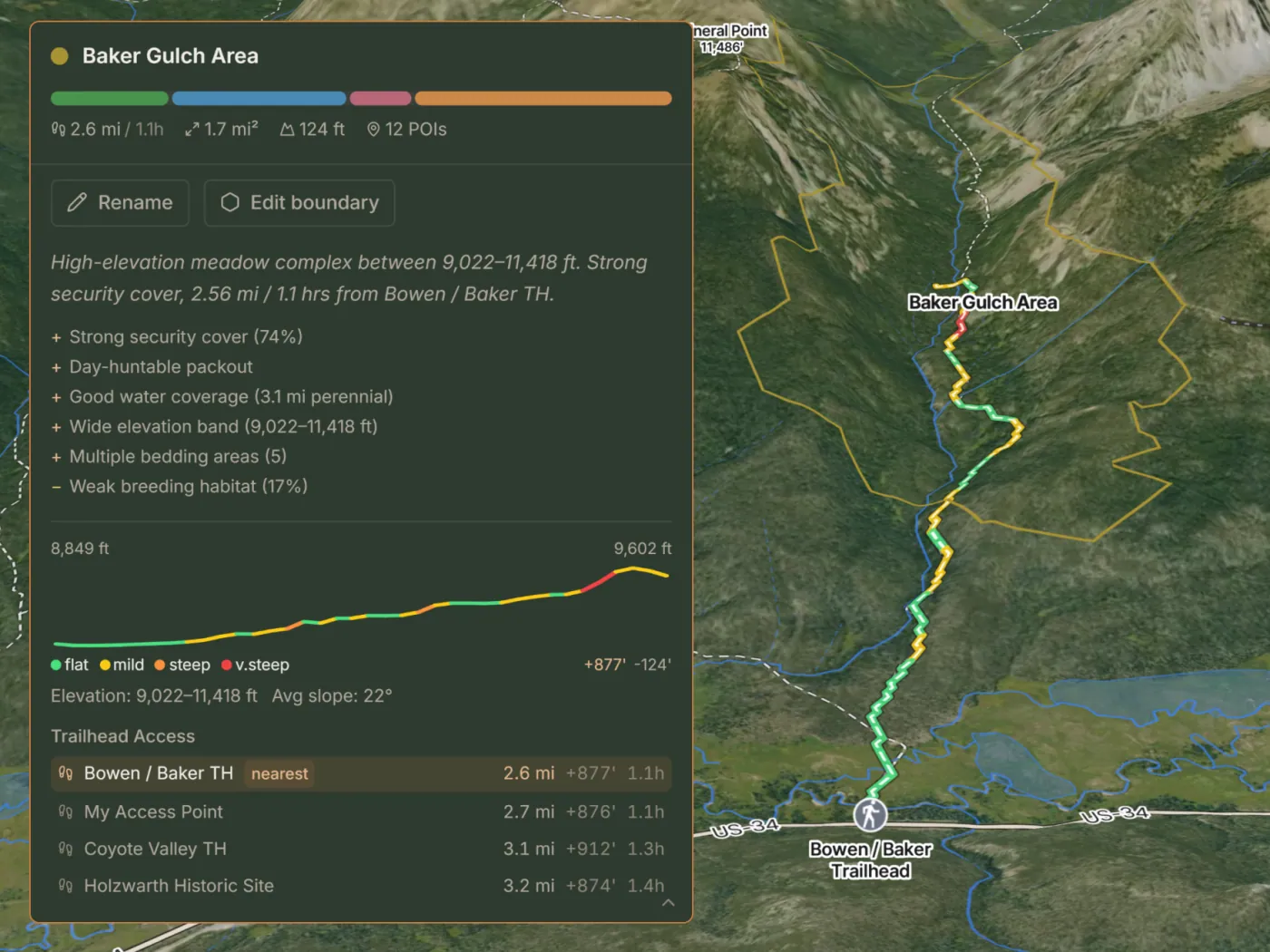
Getting in
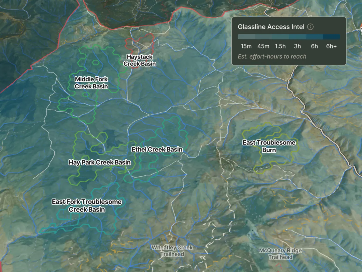
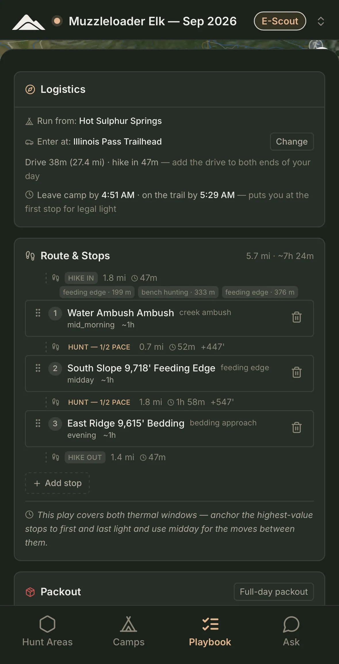
Seasonal closures, the roads your vehicle can run, and the trailhead that puts you closest — drive times and hike-in estimates for each. Have your own way in? Mark it, and it competes with every mapped trailhead.
How far you go
Distance, trail and terrain against your fitness — and how far past the crowd it puts you. Pressure is a penalty in the scoring, not a target.
Getting out
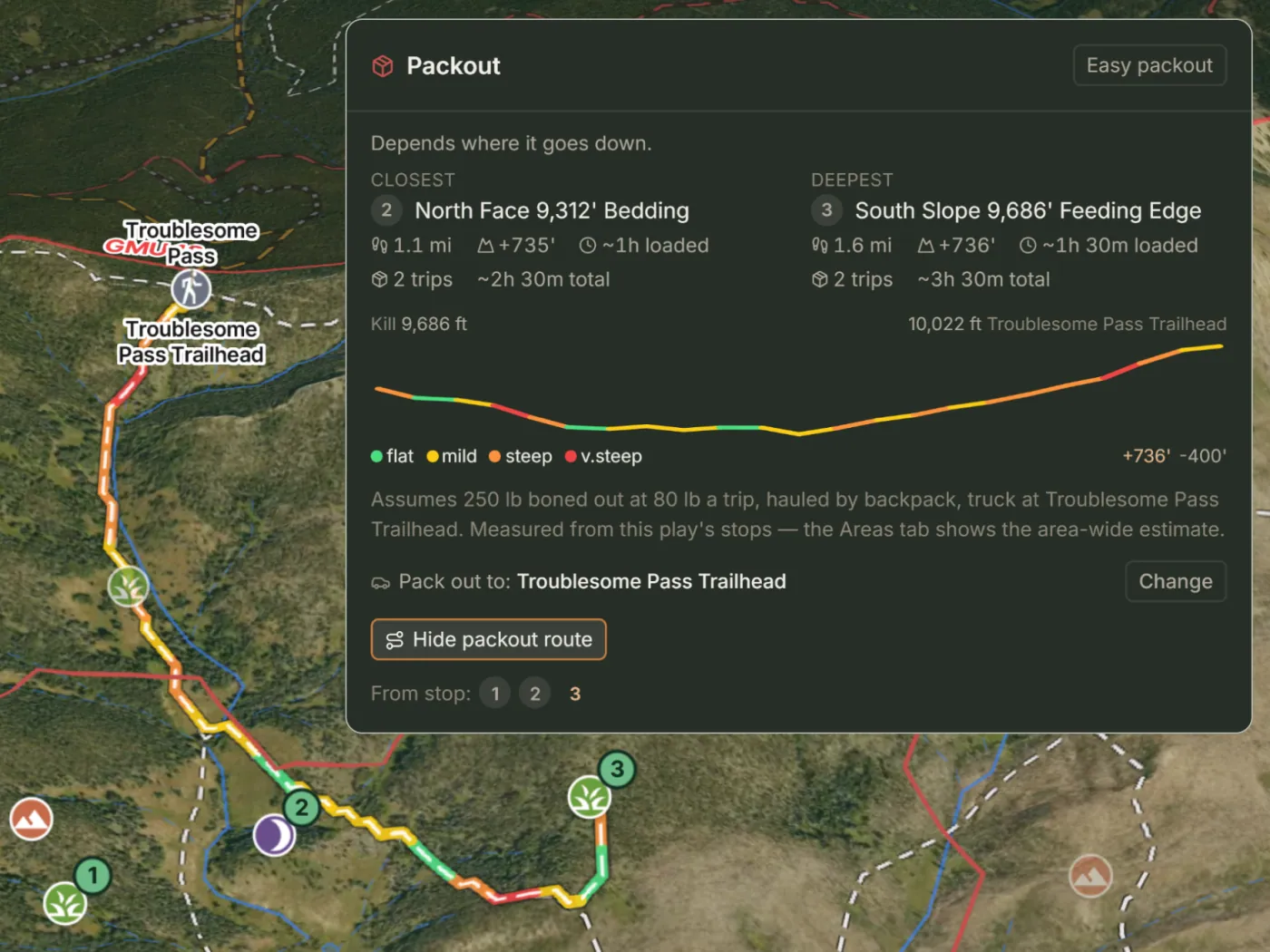
Miles, elevation, trips and hours — by backpack, game cart, or pack animals. The full cost of a kill, measured from the back of the play, before you commit to hunting it.
Plays, not just pins.
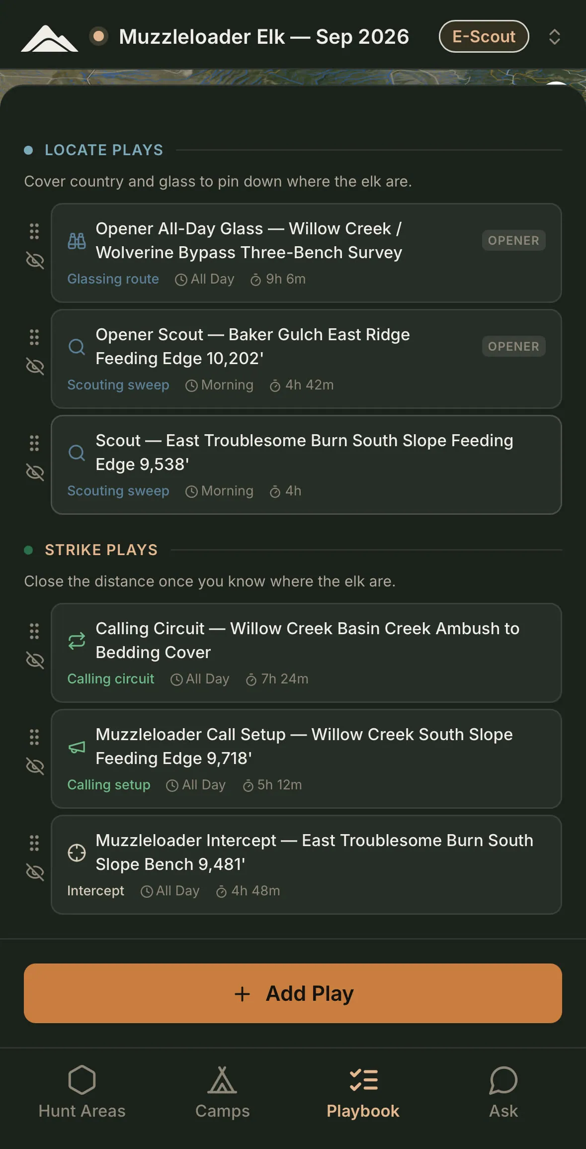
Every play is a piece of ground and a way to hunt it — the terrain it runs in, the conditions it suits, boots-on time, mileage and effort. Locate plays are about covering country and reading it. Strike plays are the move once you have something to work with. Plays are condition-aware: hot and dry, snow, cold, wind and fronts each add options in your playbook for you to weigh.
Your tactics shape the mix: call rather than sit, timber rather than open parks, day hikes rather than a bivy. Weapon, season and party size shape it before that.
Plan on the web. Run it on your phone.
Run the playbook.
Hunt mode
Entered, never assumed. Inside your dates, the phone offers hunt mode once a day. Plan lays out the day; Run works it; Relocate moves camp; Ask interprets what you're seeing.
Conditions and alerts
Snow against normal, drought, greenness, fire and a 7-day forecast. A nightly scan raises alerts for wildfire, snow, drought and forecast changes. Review what shifted, then apply the update or skip it.
Offline
Offline maps and a logistics kit for your hunt: imagery, terrain, the LiDAR basemap, the roads your vehicle can drive, seasonal closures at your dates, every glassing point's viewshed. Build a play at camp, run it, move camp, log what you see. Drive and hike times are estimated on the phone, marked "~", and rechecked when you're back in service.
Field log
Observations and marks, logged where you stood, with bearing and elevation. Confirm a terrain candidate on the ground and it counts a little more in your plan's next update. Your records shape your plan and no one else's.
Rebuild the plan. Keep your work.
Rebuild the plan and Glassline rebuilds what it generated: its areas, marks and plays. Everything you drew, edited, kept, placed, built or wrote stays. Small changes to your setup update the plan in the background for members; re-placing areas always waits for your click.
Labels that tell you what you're being handed.
When a play asks more than your budget, an area includes ground with no public hunting access, or a number was worked out with no signal, the app says so on the spot.
Works with the maps you already carry.
Bring years of onX or Gaia pins in as GPX or KML. They shape your plan and no one else's. Send the playbook back out to onX, Gaia or Garmin. onX names, colors and icons survive the round trip.
Glassline maps the mountain, never the hunters.